Select Page

Summerfield Elementary School

Summerfield Elementary School
Guilford County Schools

7501 Summerfield Road
Summerfield, North Carolina

School

Grades:K-5
Institution:
Capacity:700
Core Capacity:850

Building Area

New Construction:52,400 SF
Renovated:42,000 SF
Total:94,400 SF

Summerfield Elementary School had consisted of 21 different buildings constructed between 1940 and 1985 including 14 modular classrooms. Not only does this 8.8-acre site lie within the town of Summerfield’s historic overlay district, but one of the site buildings (which also serves as the community gymnasium) was a treasured historic structure. The site was challenging, bisected by a high tension 14.4 KVA power company line, and seven septic drain fields which could not be disturbed, two community baseball fields, an inactive AMTRAK right-of-way, a Daughters of the American Revolution (DAR) memorial, and was the site of a Revolutionary War battle. It turned out that the site’s most buildable area also hosted an elevated water tower. Unlike prior building projects, this project was envisioned as a total reconstruction of the site. The solution to maximizing the buildable area was a two-story classroom wing with the creation of an internal kindergarten play courtyard. Extensive green features have been utilized in the design, driven by necessity as much as responsibility. The building itself is primarily ICF (insulated concrete form) construction in order to create a high-performing envelope. This method of construction also allows for a faster-paced construction schedule.

The Centrum

This wide lobby is the intersection of the two large public spaces: the cafeteria and library, and accommodates the high traffic of lunch changes and assemblies. The window seating bench allows this space to be used as a teaching area. The floor map fills a 27′ diameter circle where the main corridor’s gathering area looks into the kindergarten courtyard at the entrance to the cafeteria and the library. The blue circle above represents the dome of the sky.

The World from Summerfield...

This junction is also home to the school’s map of the world as centered on Summerfield, North Carolina which is identified by the red star. The map is a custom waterjet pattern using vinyl enhanced floor tile. This map may look a bit unusual because it was created from an equidistant azimuthal projection. That means that distances can be measured on a uniform scale from the center of the map to any other point along the radius.

It's a small world afterall...

This type of map is similar to great circle maps which are typically drawn looking down on the poles or from a point on the equator. This map differs in that the exact center of the map is the Summerfield Elementary School. Cities can be located on the map by calculating their distance from Summerfield, NC and locating them along the appropriate bearing. The map is oriented by the compass so that “north” on the map points north.

The floor map can be used as a tool for mathematics, geography, geometry and social studies.

Azimuthal equidistant what?

The floor map is designed so that places within 5,000 miles of Summerfield can be located on the map using a common scale when measured from Summerfield (at the center). This is called an “azimuthal equidistant projection”.

On this map, 21’ is equal to about 10,000 miles, so the scale factor is 1 foot = 477.213 miles. You can determine how far away a place is and its bearing (by using geometry or one of the many online resources) and then locate it on the map.

The Map Chain

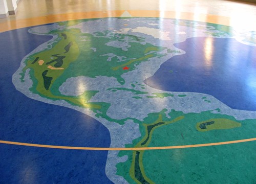
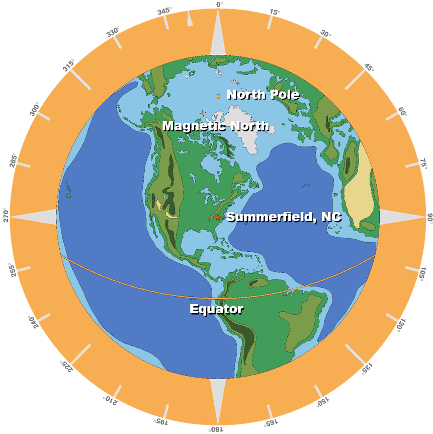
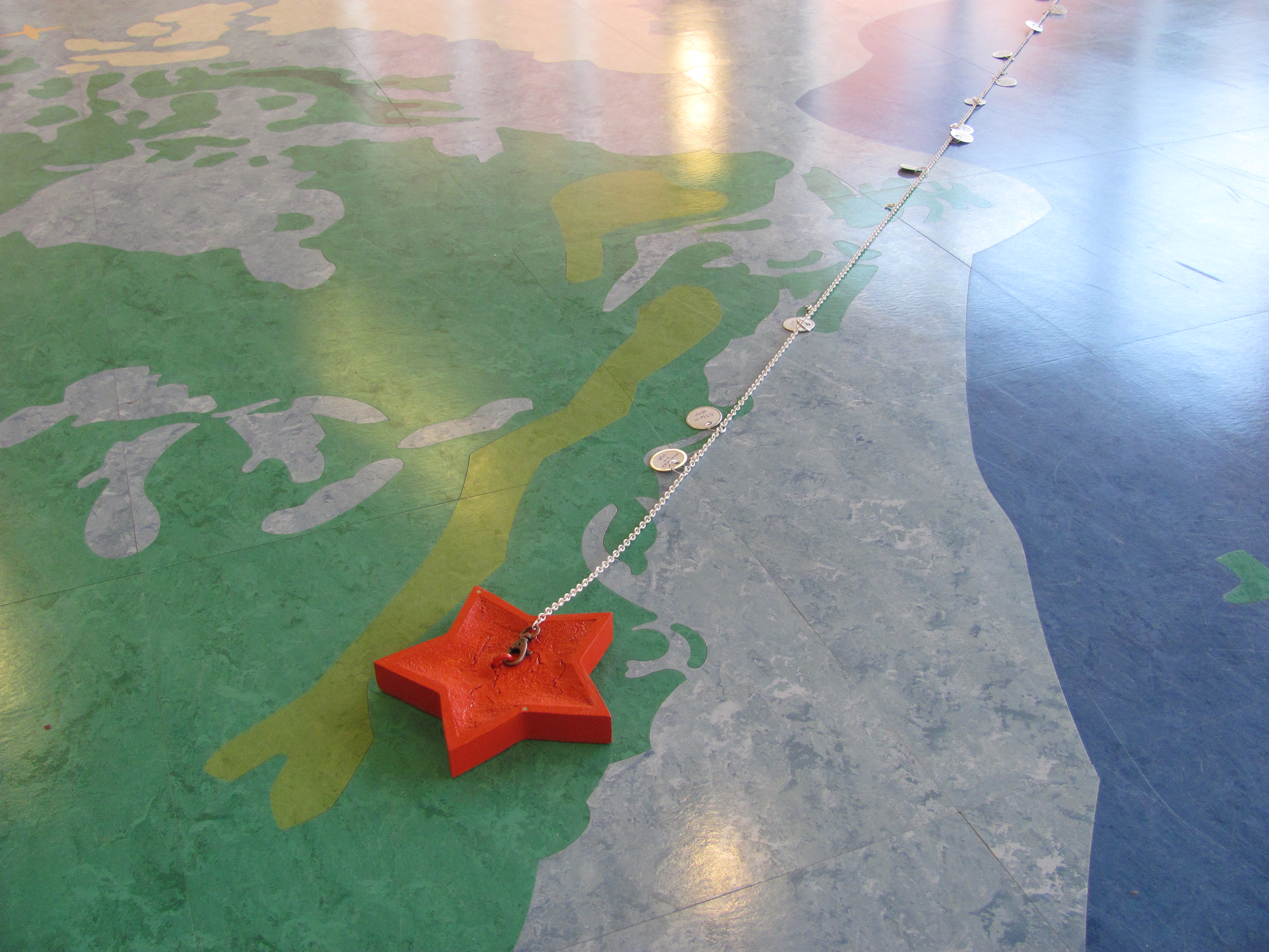
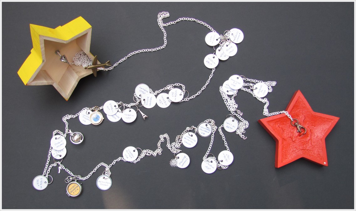
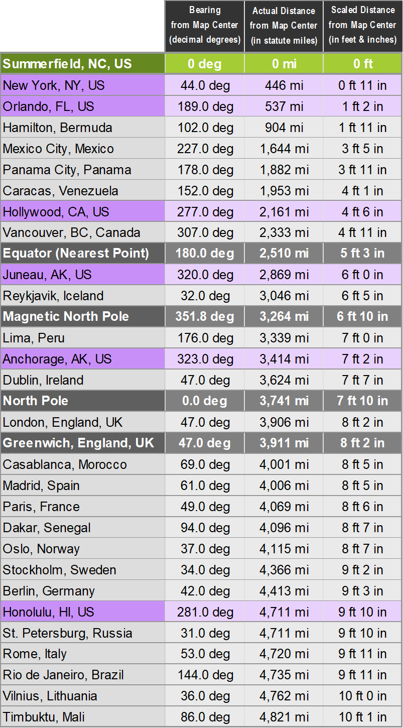
Our interior designer (who has a great fondness for maps) created this map chain in order to illustrate how the map works. By placing the red star at the one end of the chain over the red star at the map center and extending the chain to the outside of the circle (as an airplane might fly), a number of cities can be seen according to their proximity to Summerfield. Each city tag has a bearing listed, so if the chain is aligned along the bearing angle, the city can be located on the floor map.

The chain itself has a marking at each foot (1 through 11) to assist in adding other cities to the chain in the future. Several other charms mark the chain as well. The globe marks the geographic north pole. The magnetic north pole is marked by a locket so that as the pole migrates, the information inside can be updated. The chain also has a working watch charm which is located at Greenwich, England, UK. It has been set for Greenwich Mean Time (or Zulu time).

Which way from here?

Distances were calculated using the website:http://distancecalculator.globefeed.com/World_Distance_Calculator.asp

Summerfield Elementary School